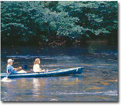
Type of River: flat water-some rapids-beginner to intermediate
The
Toccoa and the Ocoee are the same river, but it is the "Toccoa" from its
headwaters on the Blue Ridge in Georgia until it crosses north into
Tennessee.
This is the home of the official Forest Service "Toccoa River Canoe
Trail" which runs from Deep Hole campground down to Sandy Bottoms.
Rapids are class I-II with one set in the middle that approaches class
III. Butt Bridge and Toccoa Valley Campground offer alternate takeouts
and shorter runs; 8 miles and 11 miles respectively. There are also
several primitive access points along Dial Road between Butt Bridge and
Dial Bridge. There is NO good access in the 6 mile wilderness
stretch between Margret and Butt Bridge, so bring your food, water,
first aid kit, etc and be prepared as if you were hiking.
It's a spectacular all-day WW canoe wilderness cruising section and a
good training run for intermediate kayakers. Whitewater boaters will
have very little fun as there are some very long flatwater stretches;
bring the long boat if you are planning to kayak this one, or be
prepared to do a lot of wallowing tediously down the river. There are no
eddys to play in worth mentioning.
The river runs close along state highway 60 a couple miles from Deep
Hole to the town of Margret, then heads west into the National Forest
around the back side of Tooni Mountain. The next 5 miles is dense
wilderness with extremely difficult access. Midway, the Benton
MacKaye hiking trail crosses the river over a suspension footbridge. A
set of class II-III drops separated by wide eddies starts under the
bridge and continues for a couple hundred yards through a shallow gorge.
This rapid is known locally as "the Margret Drifts" - look out for
driftwood. You don't notice the bridge coming up until you are right on
top of it, due to the thick woods. Instead, look for the clearings along
the right bank as you approach, and pull out to scout. Bank scouting is
difficult to impossible; the woods are thick, steep and virtually
trailless below the bridge. Best overlook is from the bridge (see
photos) which also makes a convenient lunch stop. There are campsites if
you want to stay overnight. You could hike the trail a few miles to the
north over the mountain to get out if you had to. It would be difficult,
but not impossible, to get back up to the bridge once you've run the
ledges. Watch out for snakes.
A few miles on, the river leaves the National Forest, continues through
some scenic farm country, under the 2 back road bridges, through some
more pasture, finally past the Toccoa Valley campground on the left,
then to Sandy Bottoms another mile or two beyond. Whitewater throughout
this pleasant piece is pretty small stuff; relax and enjoy the float.

