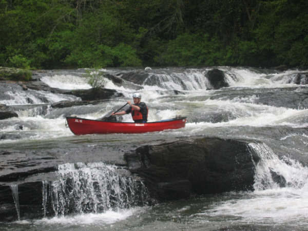
Type of River: Fast with plenty of class 3 rapids along with class 1 and 2 on the upper sections. The lower Amicalola should be attempted only by well experienced whitewater paddlers in the company of other well experienced whitewater paddlers.
The upper Amicalola is gentler (one class III rapid, easily portaged) having mostly class I and II rapids; it is also exceptionally beautiful. Each of the two sections is about 10 miles long. Both are within a government-owned, wildlife management area, and so far there is no development along the river.
South of Amicalola Falls State Park, on Amicalola Creek in the Etowah River Basin, the Georgia Department of Natural Resources (DNR) operates a 4,700-acre wildlife management area. Knowledgeable canoeists and naturalists consider the Amicalola to be one of Georgia's most beautiful and exciting waterways. More river than creek in size, the Amicalola was one of the top three candidates in the nationwide search for a river to be designated as the first National Wild River Park.
On the southeast side of the GA 53 bridge is a guide marker which graphically depicts the river, access points, more prominent rapids, and difficulty ratings. First-time users in particular should pay close attention to the information on the marker.
There are several put-in points above the GA 53 bridge, including Six Mile and Devil's Elbow. Both are state-maintained. Some parking is available, camping is allowed, and launching is easy.
The take-out for boating above the GA 53 bridge (and put-in for boating below the GA 53 bridge) is near the DNR ranger's cabin on the northeast side of the bridge. Parking is not allowed at the cabin, but adequate parking is available on the shoulders of GA 53 at the bridge.
There are no access points on the Amicalola below the GA 53 bridge until one reaches the Etowah River. Take-out is on the Etowah, 2 miles below the confluence with Amicalola Creek, at a concrete ramp near Kelley Bridge. Access to Six Mile and Devil's Elbow is reached by proceeding west on GA 53 approximately 1 mile and turning north at the first paved road (County Road 192). Turn right at the first major intersection to reach Devil's Elbow. Continue north at the intersection and watch for the sign for the Six Mile put-in.
The GA Highway 53 bridge marks a dividing point in the Amicalola's difficulty. The section above the bridge is ideal for teaching and intermediate canoeing. This section begins as easy water and grows progressively more difficult.
Several long "rock gardens," a 5-foot drop, and a deceptive "roostertail" mark this section. Below the GA 53 bridge is the most difficult water on the river. Beginning with the "Edge of the World," a Class IV rapid about .5 mile below the bridge, there are several Class II–IV rapids which should be attempted only by expert boaters. Low-water conditions usually are present after June. A foot trail leads down the east side of the river to "Edge of the World."
The beauty of this river, with its steep banks, gorges, and mountain vegetation, cannot be overemphasized.

